So, You Think You Love Horses?
Some Reflections on the Nature of Horses and Man
More Discussions by The Accidental Horseman
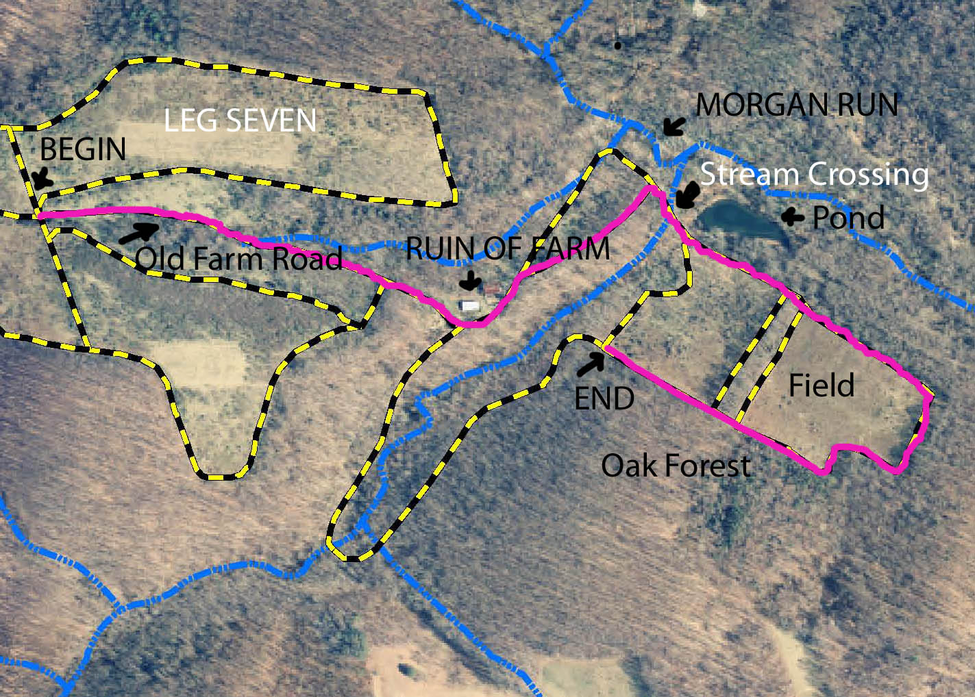
Horseback Riding at Morgan Run Environmental Nature Area
Near Westminster, Maryland
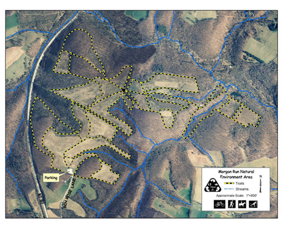
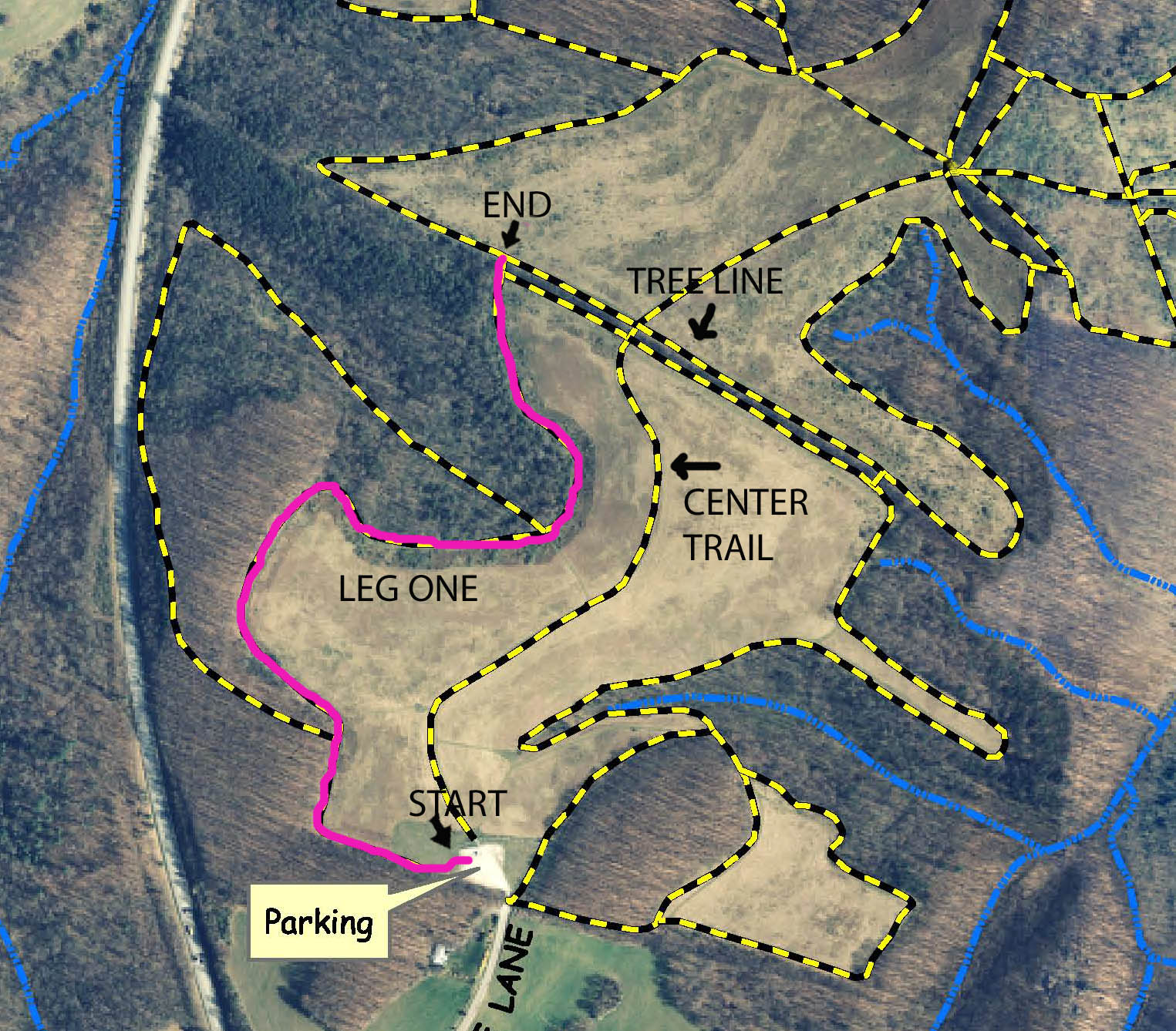
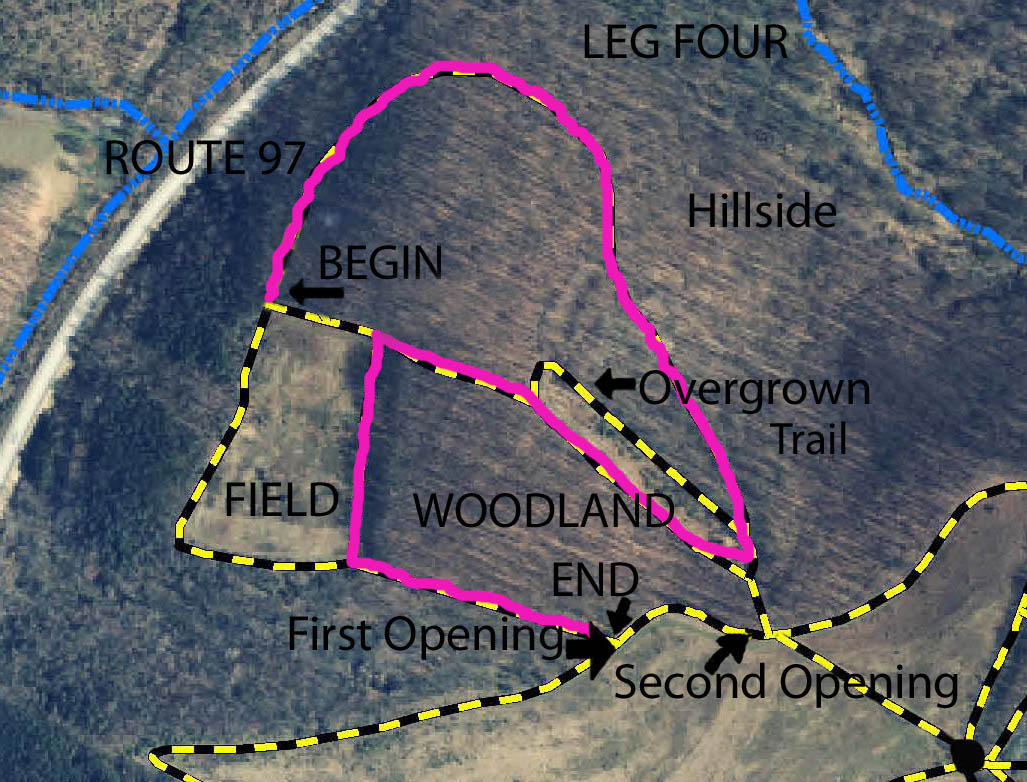
Master Map of Morgan Run Equestrian Trails
Morgan Run Environmental Nature Area
Near Westminster, Maryland
Corrected to Show Trails as Exist
|
Morgan Run is a 1,336 acre environmental nature area located in Carroll County, Maryland off of Route 97 south of Westminster. The site was acquired by the State of Maryland in 1975 as a watershed and the riding trails were created in 1991 through the efforts of local riders. It is a great place to visit for trail riders living in the central Maryland and Washington, DC metropolitan areas. It features 11 miles of equestrian trails in both open field and woodland setting. There are many long, broad, open stretches suitable for long canters and also narrower, meandering trails through old oak woodland. Only a few sections are somewhat rocky, but the vast majority of the trails have footing that is easy on horses' feet.
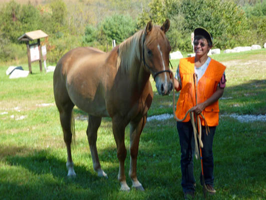
Another Horse and Rider in the Parking Area
|
|
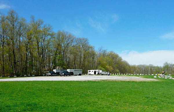
Morgan Run's Trailer Parking Area
| |
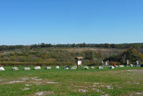
Unlike many other parks there are two-lane roads leading to Morgan Runs ample parking area. If you are heading north on Maryland Route 97 you would make a right on Bartholow Road and if headed south, make a left. Once on Bartholow Road you go only a short distance and make a sharp left onto Ben Rose Lane which dead ends in the trailer parking area. The parking area is very large and can accommodate many trailers of all sizes. The center of the parking area is crushed stone, but there is a low lying area to the right that is grass, and the ground can be soft in very wet weather. I have seen a few people get stuck in the wet ground over the years, so exercise good judgment if you consider parking there. There is a Port-A-John located in the parking area which is maintained from contributions made by members of the Carroll County Equestrian Council.
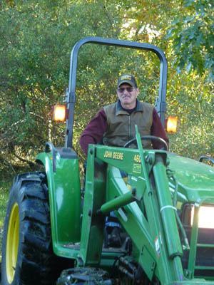
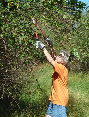
I should also mention two problems with Morgan Run. Certain years, but not this last year, ticks are abundant in the park. I find that in season I must check my horse's legs for them. We keep a small pill bottle in the horse trailer and pop then into it. Alternatively a piece of tape wrapped around the finger then folded over works well. The ticks you collect will not have had enough time to attach themselves. A second pest at the park is flora not fauna: bush honeysuckle. They are a non-native, invasive Lonicera species. They often overgrow into the trails and the Carroll County Equestrian Council, a volunteer organization that helps maintain the trails, regularly cuts them back only to see them grow back months later. Watch out for the occasional branches of these extending into the trail, but I believe you will find that the trails at Morgan Run are better maintained than those at many other places you ride.
Equestrian Council Mowing Trails at Morgan Run
|
|
|
Equestrian Council Volunteer Clipping
| |
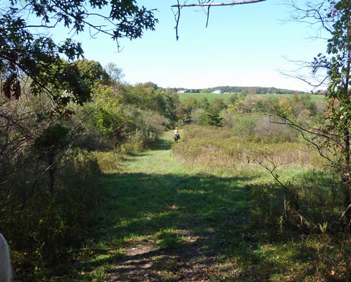
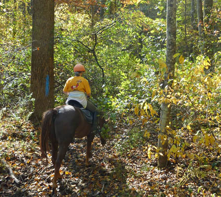
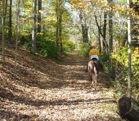
If you are a first time equestrian visitor, I now will take you on a virtual tour of the trails. Once you off-load at the parking area you will discover that there are three different trails leading north into the park from the parking area. There is also one going west (to your left if facing north) and a not-so-obvious one in the trees on the east (right side) of the parking area. This situation is true of many of the places at Morgan Run; it is not just one big loop. It is a series of many loops with several points that serve as hubs. There is a trail map on the bulletin board, but generally you can go to a high point and navigate by line of sight. The main and largest trail is the center one on the high ground, and it leads to an opening in the center of a tree line that you can see in the far distance. This is worth noting as an orientation point but instead of taking that trail, I will ask you to follow a simple initial proven strategy that is suitable to the easily lost horse person. Travel northwards and clockwise around the border of the park's trails. When given a choice always take the left fork as long as it appears to be a well traveled path. Once in the park there is no signage pointing the way home. This is truly a natural area.
Distant Tree-Line from Parking Lot
|
|
|
Leg One: Western Opening in the Tree-Line
| |
Morgan Run Leg One
|
| 
|
LEG ONE
Well, let's go. We turn to the left and ride through a line of large white boulders that border the parking area. We cross a flat mowed area that has two picnic tables and enter the left most trail that heads westward out of the parking area. Once on the trail it slopes downhill and then makes a ninety degree turn to head north and then runs fairly parallel to the main trail that I pointed out earlier. Not long after your turn there is another narrow trail to the left, but we will not make that left today. You can explore that another time. It is a loop that runs downhill to go along Route 97 and then runs back up to join the one we are now on farther up the path. It is rocky, washed out in places, and is often overgrown. We continue on an undulating mowed trail with woods to your left and scrub brush to your right that makes a few twists and turns but is okay for a trot or canter along the straighter portions.
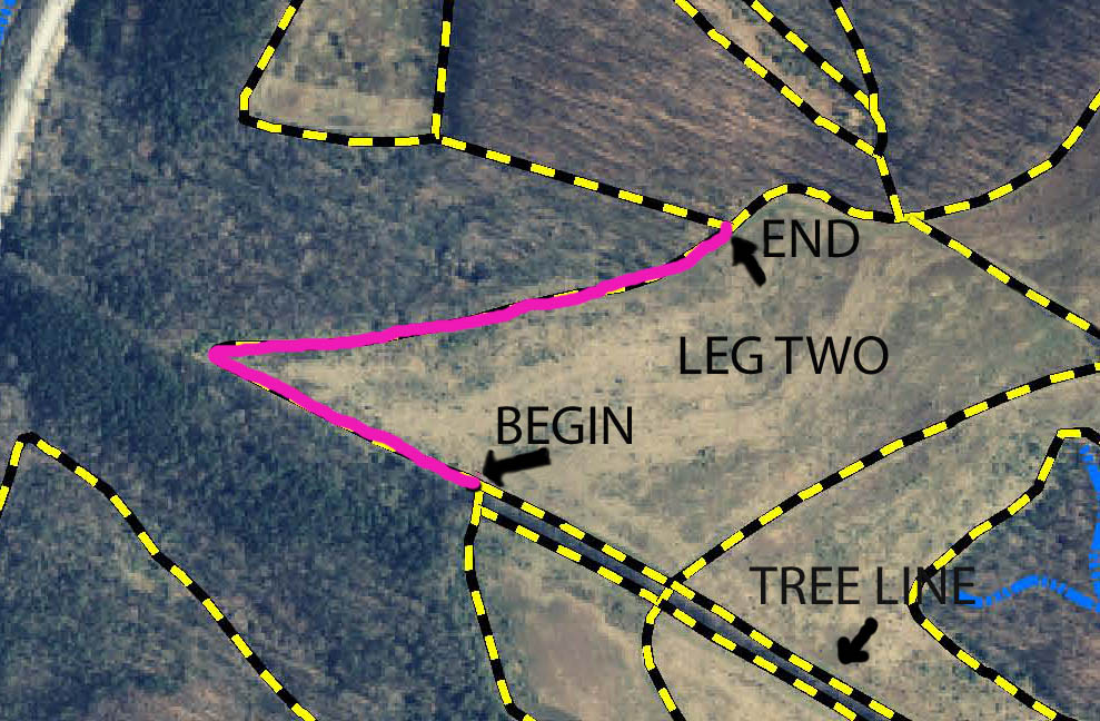
At last we come to that straight tree-line that we saw in the distance from the parking area. This tree-line is on high ground and an important landmark in the park. There are two straight trails on either side of it that cut across the trails leading away from the parking area. The tree-line has three openings that pass through it. We have just come to the westernmost of the three. The main central trail passes through the middle of the tree-line, and there is a third one over on the east side of the tree-line which we will pass in the future.
LEG TWO
Morgan Run Leg Two
|
|
|
Morgan Run Leg Three
| |
So, we have completed the first leg and now pass through the tree line and turn left. You are now headed downhill. You can see a few houses in the distance that are located on the other side of Route 97 and are a reminder that even in a 1,336 acre park civilization cannot be totally escaped. When you come to the bottom of the hill you have no choice but to make a sharp right turn that now has you headed east and on a slight uphill grade. Halfway up the hill is a large opening in the woods and we will turn left into it. We have now finished the second leg.
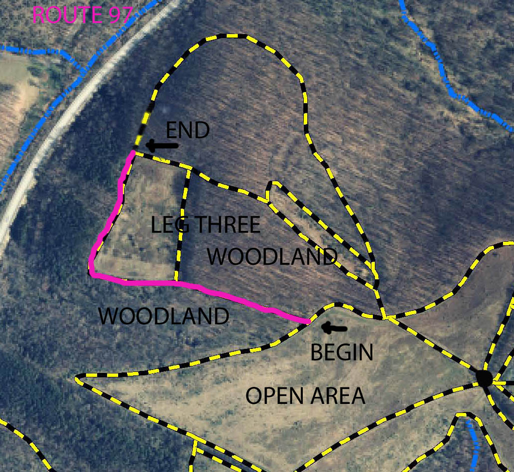
LEG THREE
Leg Three: The First Opening to left
|
|
|
Leg Three: Going Along the Old Farm Lane
|
|
|
Leg Three: Exit into Rectangular Field
|
|
We are now in an old growth, oak wood and on that must have been an old farm lane at one time. The trail is sunken and the footing is hard. We are just walking on a slight downhill grade. This trail ends in an open rectangular field now occupied by scrub brush with mowed trails on all four sides. We continue along the south edge of this field and turn right at the end of it. The trail makes a dip first down then up bringing us to the northwest corner of the field and an opening in the woods. We have now finished the third leg of the tour.
LEG FOUR
Morgan Run Leg Four
|
| 
|
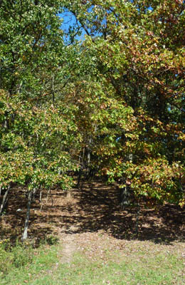
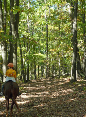
We plunge into the opening and the character of the trail changes abruptly. This trail is narrow and obviously not mowed and not grassy. We are riding through an oak forest along a hillside trail. You can hear the sound of traffic on Route 97, which is down the hill to your left but the drivers would never guess we where back here. During this leg of the ride you are as far away from the parking lot as you will ever be and along the northern side of the park. Watch out for the multiflora rose (Rosa multiflora) along the trail. They do not get big in deep forest like this but their thorns can still get you on a narrow trail like this and they are another invasive, non-native species you can add to your invasive species "life list."
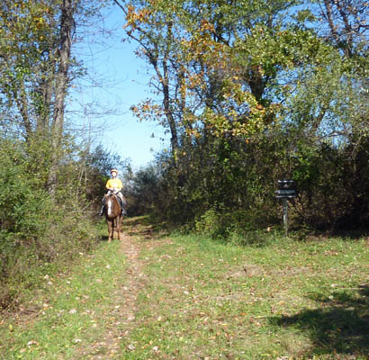
Talking about biology let me mention that you will see some wildlife in the park but I would not say that it is teaming with wildlife. You also will encounter the occasional hiker, dog walker or birder. However, except during trail maintenance, you will not find any motorized vehicles or mountain bikes on these trails. Mountain bikes are permitted on the trails between the parking lot and the first tree line, but not beyond that. So, far I have only once encountered a biker at Morgan Run. The network of trails is large enough that the parking lot can be filled with trailers but you only occasionally get to say hello to another rider.
While we are thus musing, you notice that the trail is now getting steeper and is somewhat washed out and curving to the right. Up the hill you can see that we are coming to an opening in the tree-line. The opening is the next one up the hill from the one we entered at the end of our third leg. However, rather than pass thought it we are making a exceptional right turn onto a short stretch that brings as to a wide well-shaded, woodland trail that is fairly flat. The sun is higher in the sky but it is still cool in here and this is a good place to let the horses have a little canter after their long walk on the narrow trials in the oak forest. At the end of this brief canter we enter the oak forest for a short time and emerge from it on the northeast corner of that same rectangular field, two sides of which we traveled around during the third leg. This is the highest point of that field. If we went straight down the hill we would again come to that opening that took us into the oak forest. Since we have been there already we will turn left and ride down the eastern side of the field. The ground is hard here and there is a dip that brings you uphill and back to that old sunken farm road. We retrace our steps back up the road again in the other direction. My horse is getting restless and I think he wants to move out a little. We are at the first opening to the woods again and in full sun light and with open fields of Golden Rod in front of us. I sincerely hope that you took your allergy medication but know that we have finished the fourth leg.
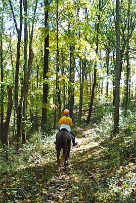
Leg four: Along the Narrow Woodland Trail
|
|
|
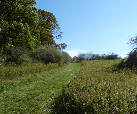
Leg Five: We canter uphill from the Opening.
This trail is typical of Morgan Run.
|
|
Morgan Run Leg Five
|
| 
|
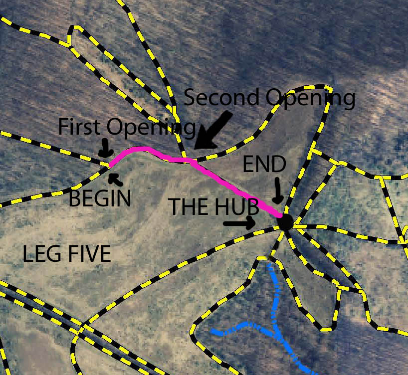
LEG FIVE
We go through the opening but watch out for any other riders on the main trail. Only rarely will there be others and my horse turns left and goes into a nice collected canter (I hope) up the hill. There is a mowed path straight ahead from the opening that is not on the official map but we will ignore that. On our left is that second opening in the woods that I mentioned before and we will also ignore that. We also will not continue on this particular trail. If we had it takes a dip down and then up hill and winds around in an inverted U shape. That part of the trail has a hard surface on the uphill stretch and instead of using it, I will turn right when passing that second opening and continue the canter down another wide short but straight trail to a point that is a critical landmark in the park. This is an area where you are most likely to encounter others and I slow to a walk before reaching the end of this cut. Thus ends the fifth leg of our tour at a landmark known as the "Hub."
LEG SIX
Our sixth leg begins at the "Hub." It is the most important land mark in the park and one that you should learn to recognize. There is a picnic table here and a tall oak tree. It is the junction of seven trails that come together here like the spokes of a wheel. It is the central point of the northern part of the park and a high point from which the various trails that lead deeper into the park all slope downward. Recognize this spot and you are not lost. If you look to the right of the trail that we were just on you will see that the next trail coming out from the "Hub" is the widest of the various trails and is a level one, leading to the south-west. It connects to the main central trail that that we saw from the parking lot. If you are late for that hot date or the sky is turning black and you feel that need to get back, a brisk canter down that trail will have you back to the parking lot in five minutes flat (well, maybe three if you ride like my wife).
The Oak Tree at the "Hub"
A Critical Landmark
|
|
|
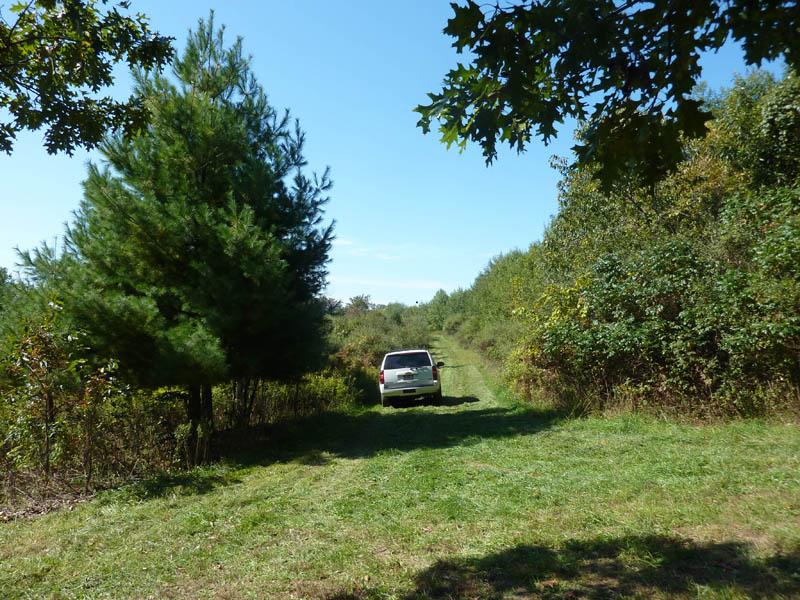
The Trail back to the Parking Lot from the "Hub"
The vehicle was doing maintenance.
| |
Morgan Run Leg Six
|
|
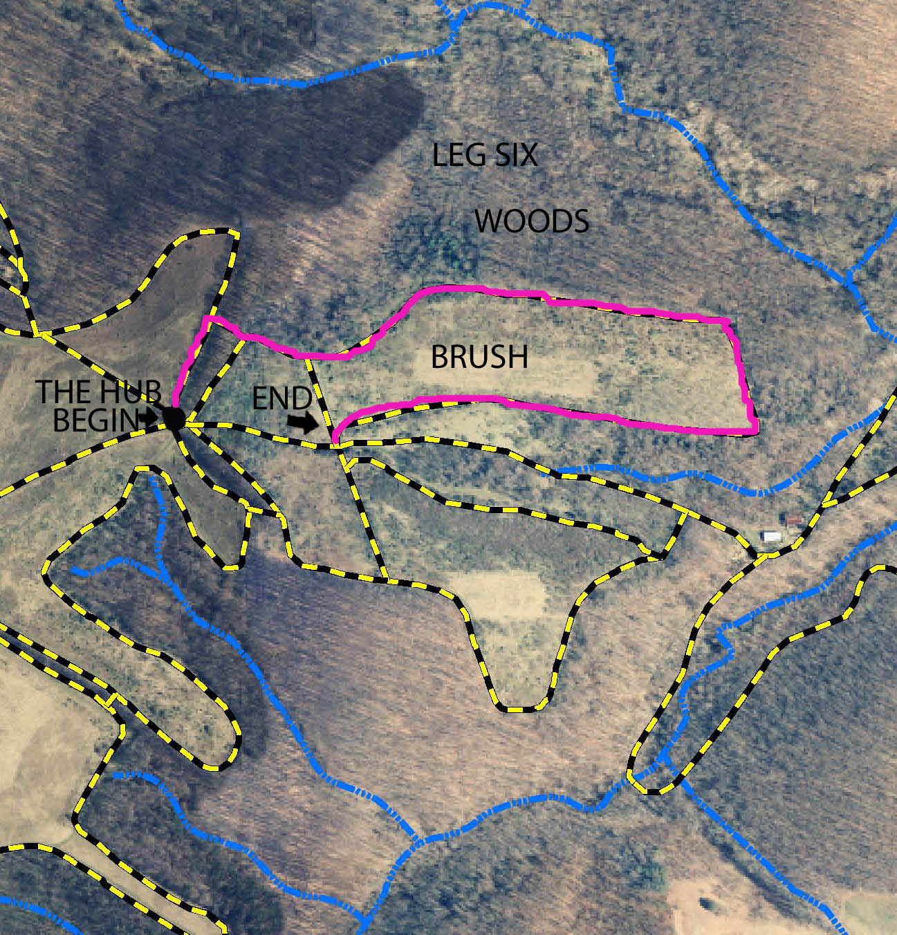
At the "Hub" we have six possible choices. The truth is that there is no right answer and we might explore all of them. They are a series of interconnecting loops and given enough time we will end up either back at the "Hub" or back at the parking area. There are only two other small openings that bypass the "Hub." The "Hub" is a spot that you are likely to encounter other riders at the park or meet up with someone who got separated from the group.
I will arbitrarily pick the first trail to the left of the one that we came out of and head north on a wide flat trail that is the eastern leg of that inverted U shaped trail that I did not take when we were cantering during leg five. Sorry, if I have lost you here but just follow me and take a right into a small opening in the tree line that connects to another one of the seven trails leading from the "Hub." We might have just gone down that trail too but I think doing the next left one of the seven is easier to remember. This opening is one of two that bypass the "Hub" entirely. We are now on a trail that has woods to our left and a grown-up field with smaller trees to our right. Viewed from the air it has an odd shape but fairly rectangular. From the ground you do not have a feeling for its geometry. A short distance down this trail there is a cross-trail to the right that is a shortcut and that we will ignore. Follow the main trail on the left around and understand this trail goes on for a long distance. The last part of it is a long uphill straightaway lined with those evil bush honeysuckles. You will finally dead end on one of the smaller cross-trails. In fact this trail is the other end of that shortcut, cross trail that we avoided earlier on this leg. Here we turn left and after the shortest of distances left again. This brings us out on a wide old roadbed that heads off on a downhill course. If you had turned right at this point and do not, it is just a short distance uphill and back to the "Hub." At this point we have ended the sixth leg of the ride.
LEG SEVEN
Morgan Run Leg Seven
|
|
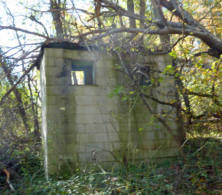
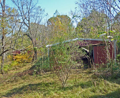
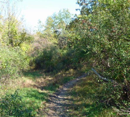
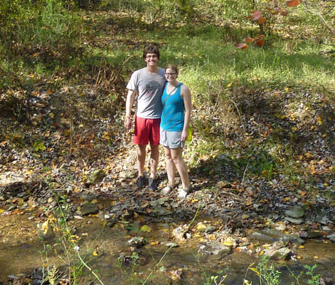
We are now on an old farm lane which slopes downward toward Morgan Run, the stream that gives the park its name. After you have continued on this for a distance you come to the remains of a farm, the old Honbarrier place. There is what looks like a cinder block outhouse on the side of the hill and also the porch of the farmhouse, but dwelling itself is totally gone. On your left are several steel buildings, which appear relatively new but they too have been slowly deteriorating as the woods reclaims them. At this point another trail intersects to the right and the main trail curves to the left. We continue on the main one with a slight left turn and after a short distance come to a fork in the trail. We might go either way and there are advantages and disadvantages to both trails. Either will take you to the same point ahead but I suggest using the one on the right as the left is fairly overgrown. You pass a corn crib that looks like a big bird cage on the left. The trail becomes a fairly steep descent here and this is one of the few stretches that is rocky and washed out. When you get to the bottom of the hill you turn to the right and cross a small stream that flows into Morgan Run. Morgan Run itself is just to the left of you and is visible during the winter but the brush and trees hide it in the summer. You might be aware of people fishing in it in season. There are also areas within the park that are open to hunting in season but most of the riding trails are in areas restricted to hunting. As a precaution we always wear orange clothing during any kind of hunting season. We have encountered bow hunters on a few occasions. We tend to stay out of woods during rifle season. You are now at the low point of your trip or maybe I should say the lowest elevation. The trail is flat and turns just a little to the left through a path lined with multiforal rose. You pass another trail to your right that we will ignore. On your left is a fairly large pond. Once you are out of these woods there is fairly square field. Continue along the straightaway and ignore the two cross-trails that abut this main trail from the right. At last you come to a 90 degree bend in the trail and an oak forest. There are two trails that enter the field from this forest. They head off into private property and there is no point in exploring them. The main path leads uphill and around, then through a tree line and then descends a slope which is a little rocky. At this point the trail intersects with another one and there is an opening in the oak forest you your left. We have just ended the seventh leg of the ride.
Leg Seven: The Block Outhouse
|
|
|
Leg Seven: Remains of the Old Farm Buildings
|
|
|
Leg Seven: I favor the right fork here. Notice the right is more traveled.
| |
Leg Seven: The "Bird Cage" Corncrib
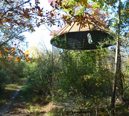
|
|
|
Leg Seven: We sometimes encounter hikers
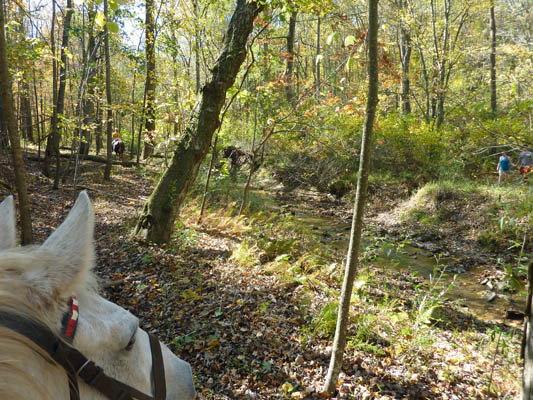
|
|
Leg Seven: The Hikers
|
|
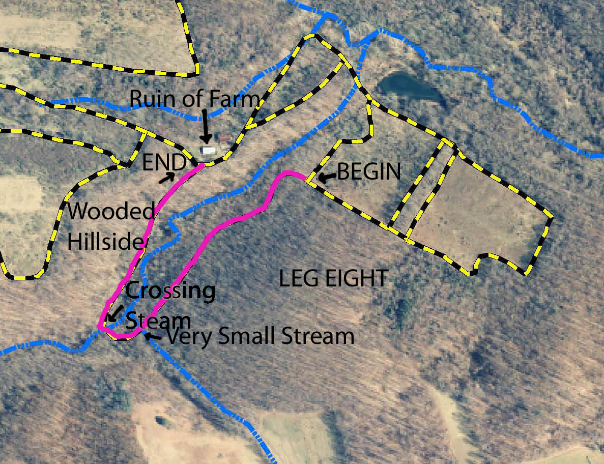
LEG EIGHT
Morgan Run Leg Eight
|
| 
|
The trail that we have encountered is the other end of one of the ones that we ignored during the seventh leg. We turn left and into the oak forest and walk along a narrow trail that has a few rocky areas. On your right is the small stream we crossed during the seventh leg. The trail meanders into the woods and finally turns to the right at a very small watercourse. You are on the park's eastern boundary now and the land just to your left is private property marked with blue paint on the trees and no trespassing signs. At last you come to that stream you crossed before but at a higher point along its course. You need to turn left and walk in the stream for a couple feet before the trail then continues on the right bank and curves to the right and away from the private property line. You now intersect with another old farm road built into the hillside. If you turn left here, it leads into posted private property. Turn right and go up the hillside. There are a few areas that are rocky or just a little wasted out or muddy but for the most part it's not too bad. Finally we reach the top of the hill. This was a nice leg through woods that is particularly colorful in the fall and very peaceful with its meandering streams. We have just ended the eighth leg of the ride.
Leg Eight: I walk the Line
|
|
|
Leg Eight: Crossing the Stream
|
|
|
Leg Eight: Back up the Road
| |
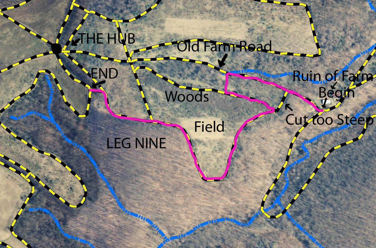
LEG NINE
Morgan Run Leg Nine
|
|
At the top of the hill you turn left on the same trail we were on during the seventh leg of our trip. We are at that old ruined farm again and round the corner and head back up the same old dirt road and once again see the block outhouse now on our left. There is a trail coming down a rather steep slope on the left which I want to pass by but we turn on the next one on the left which is not steep. If we had not turned left but continued straight on the old dirt road we would soon be back to the "Hub." I am in the mood for a longer ride so I plunge back into that spider web of network of trails, which is the only way I can characterize riding at Morgan Run. After about two horse lengths of a connecting trail, I turn to the left and now I am riding on another trail that runs parallel to the old farm road and but we are now moving in the opposite direction along this one and at a slightly higher elevation. After a distance you dead end on a cross trail and turn right this time. If you had turned to the left you would go down that steep slope and end up back on the old dirt road we just came off of. We follow this new trail around with an old oak forest to our left and newer growth to our right. You go up a hill side and bear to the left where there is a small overgrown field located on the right. Next we ignore that cross trail intersecting on the right. The trail becomes narrower and there are some blind curves so watch out for horsemen coming from the other direction. Often you hear others talking and know that other riders are approaching. Finally, you come to a small and easily missed opening in the tree line on the left. This is the other one of the two openings that bypasses the "Hub." We will turn left here, pass through the tree line and turn left on the next trail. Both this trail and the one that we had been on would have ended at the "Hub" if we had continued to go uphill on either of them. However, we are going downhill and away from the "Hub" again. This ends the ninth leg and I can see that everyone is getting a little tired. We have been out about two hours at this point and covered a lot of ground.
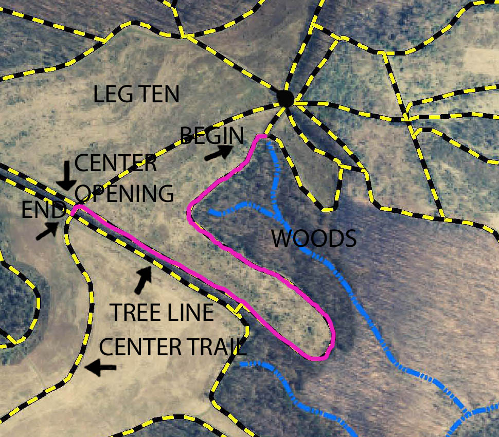
LEG TEN
Morgan Run Leg Ten
|
| 
|
|
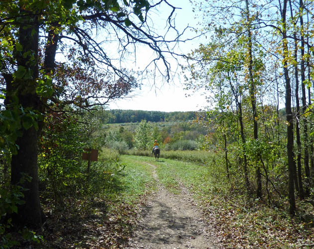
On the tenth leg now we are heading home but not by the most direct route. We are following a path that goes downhill and curves to the right then uphill and dead ends on another trail coming from the "Hub." In fact, this is so close to the "Hub" you can see it if you look uphill and to your right. However, we will turn left and travel along a hillside and away from the "Hub" again. This trail goes downhill for a distance and finally curves around and heads uphill. You are now on the outer one of those two trails that parallel the tree-line that we noticed when we looked in the distance at the parking lot. We were on the other end of the same straight trail that we were on during the second leg of our trip. After you go a short distance up the hill there is an opening in the tree line and an intersecting trail. This is the third and eastern most of the three opening in the far tree-line that I mentioned. We could go that way but this time I am bypassing it and continuing uphill on the straight path along the tree line. When we get to the top of the hill we intersect with that main central trail of the park and the central one of the three openings in the tree-line that we noticed in the parking lot. We turn left and pass through the tree-line and the end of the tenth leg.
Leg Eleven: The Central Opening in the Tree-Line
|
|
|
Leg Eleven: The Trailer Park from the Main Trail
| |
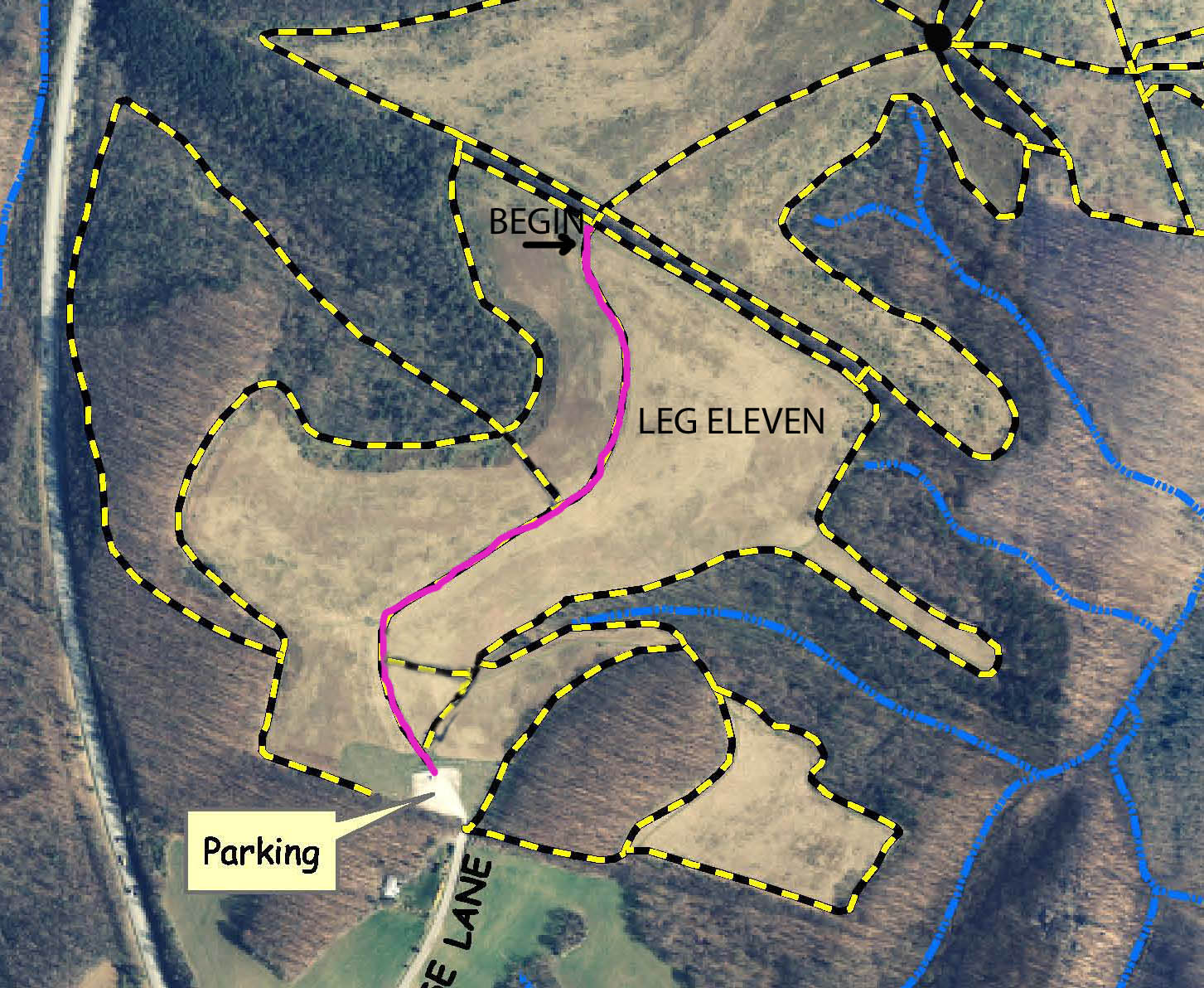
LEG ELEVEN
Morgan Run Leg Eleven
|
|
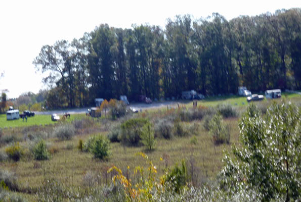
We are now on the final and the eleventh leg of our journey at Morgan Run. We might have added more because there are many trails and loops that I skipped but save them for another time. I do not think Maria is good for too much more riding and the all the horses are fairly lathered. This is a high point in the ride and you get a look view of the park from this point which is why I am returning through the central opening. In the distance you can see the trailer parking area and the south border of the park. You know the way home and are relieved that you are not lost. There are trails to the right and left which slope downward and are parallel to the tree-line but we will ignore them this time. However, if we would turn all the way around and traveled away from the parking lot again, that would be that wide and flat trail that comes from the "Hub" and that is the fastest and most direct route when returning from the "Hub." I mentioned that trail before but we have not traveled on it. However, instead of turning around we travel down the central trail to end our ride at the parking lot.
I have written this for someone who has never been to Morgan Run and base it on the path that we often follow when riding there. I hope that if you do print this out and try to follow it to the letter that it works without getting you lost but a trail rider needs a spirit of adventure and getting lost comes with the territory. Morgan Run is big but not so big that it is possible to be lost for a long period of time. A basic principle to follow if lost at Morgan Run is to go up hill. If you do that you should be going away from the edges of the park and towards the parking area, the "Hub" or the central opening in the main tree-line. Those three places are all located on the highest elevations at the park. I hope you enjoy your trip there as much as I have enjoyed my many rides there.
Carroll County Equestrian Council Helps Maintain Morgan Run

|
Yours truly,
The Accidental Horseman
.
MORE: MD State Parks Morgan Run Site
Carroll County Equestrian Council Web Site
A Virtual Equestrian Tour of Codorus State Park, Near Hanover, PA
For those curious about Maria here is her story.
Back to Additional Discussions
Links to Other Sites regarding Horses
Back to Index Page